Article published in the ‘Essex Countryside’ Magazine *after 1962.
An edited version of the full article is below.
The walk is along the top of Hadleigh Downs from South Benfleet to Hadleigh Castle.
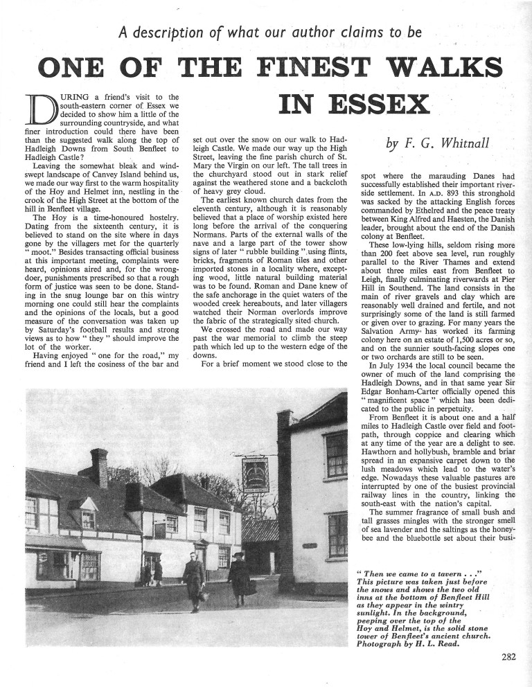
After refreshment and ‘the warm hospitality of the Hoy and Helmet Inn nestling in the crook of the High Street at the bottom of the hill in Benfleet Village.’…..
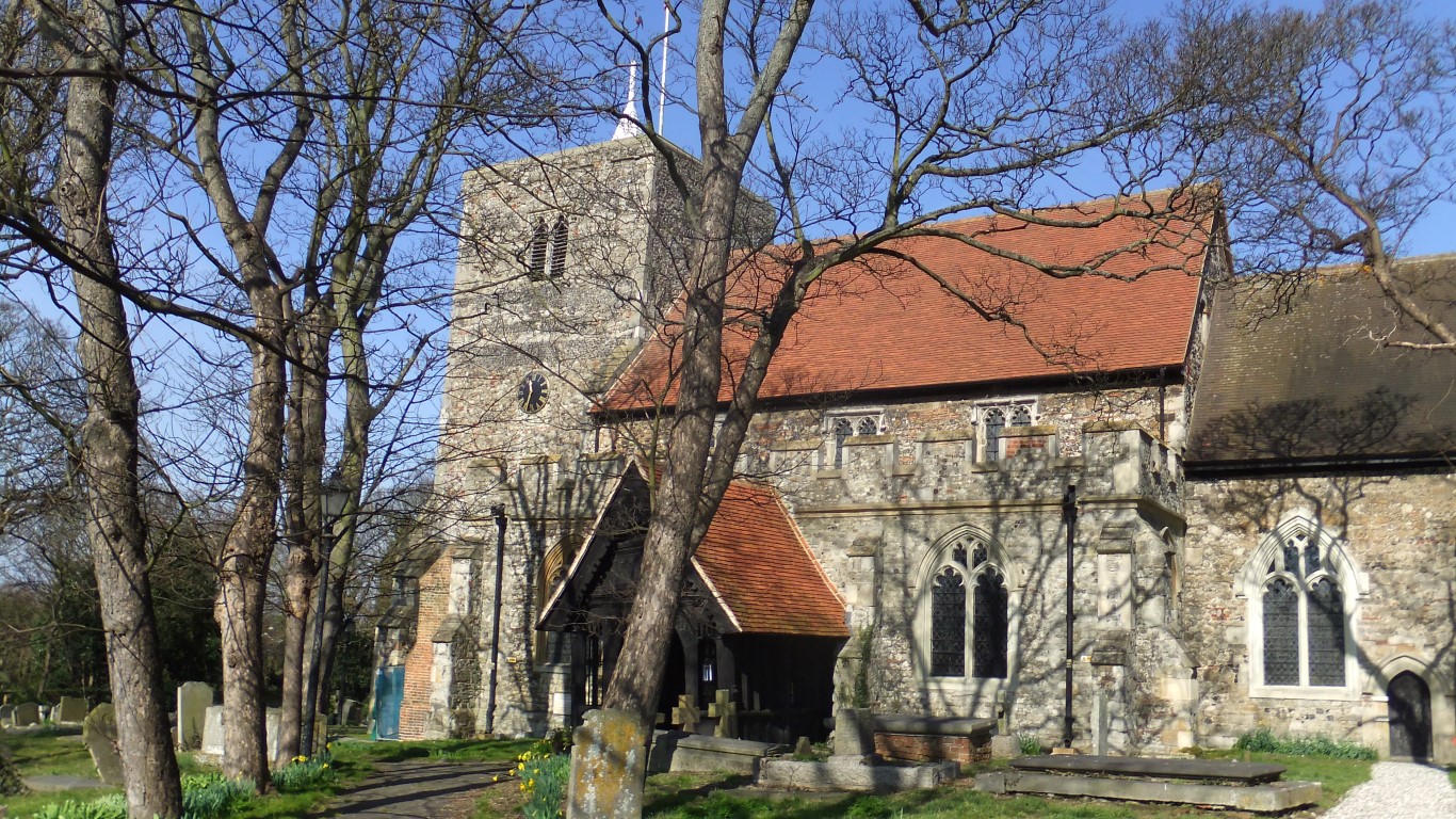
We made our way up the High Street, leaving the fine parish church of St Mary the Virgin on our left. The tall trees in the church yard stood out in stark relief against the weathered stone and a backcloth of heavy grey cloud.’….
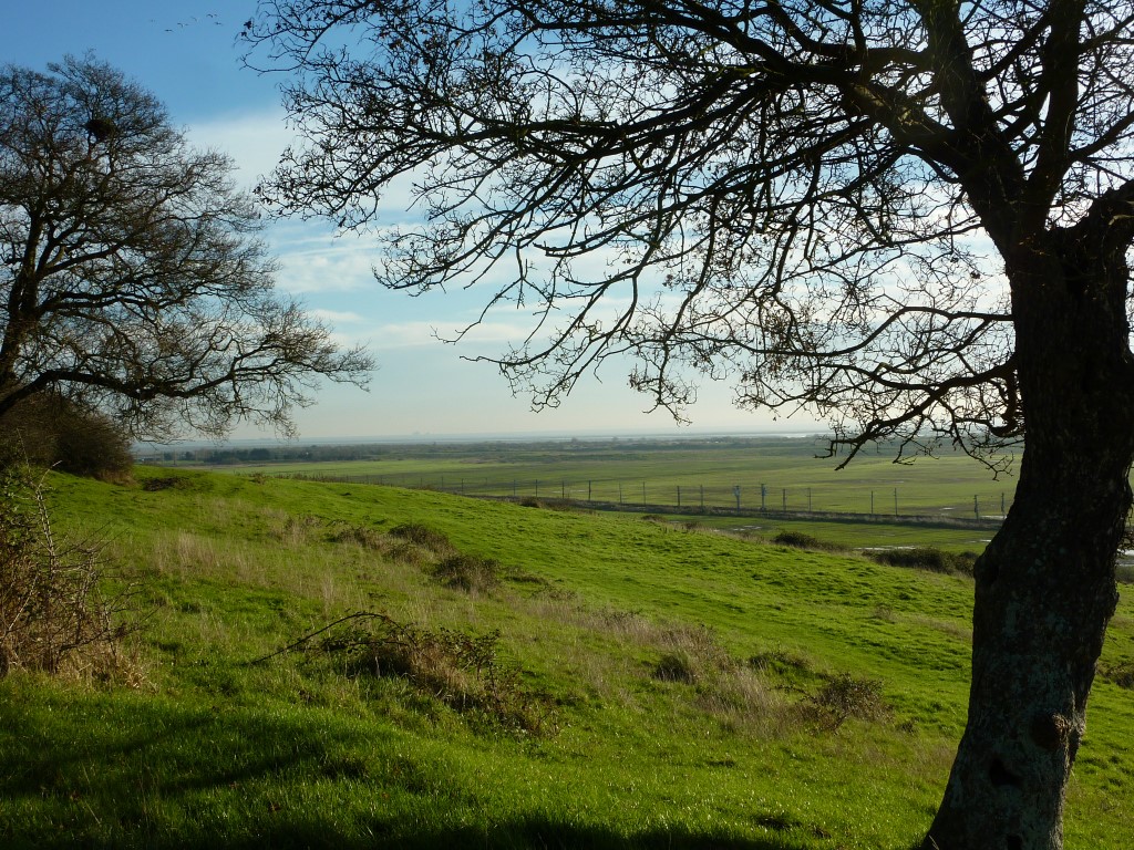
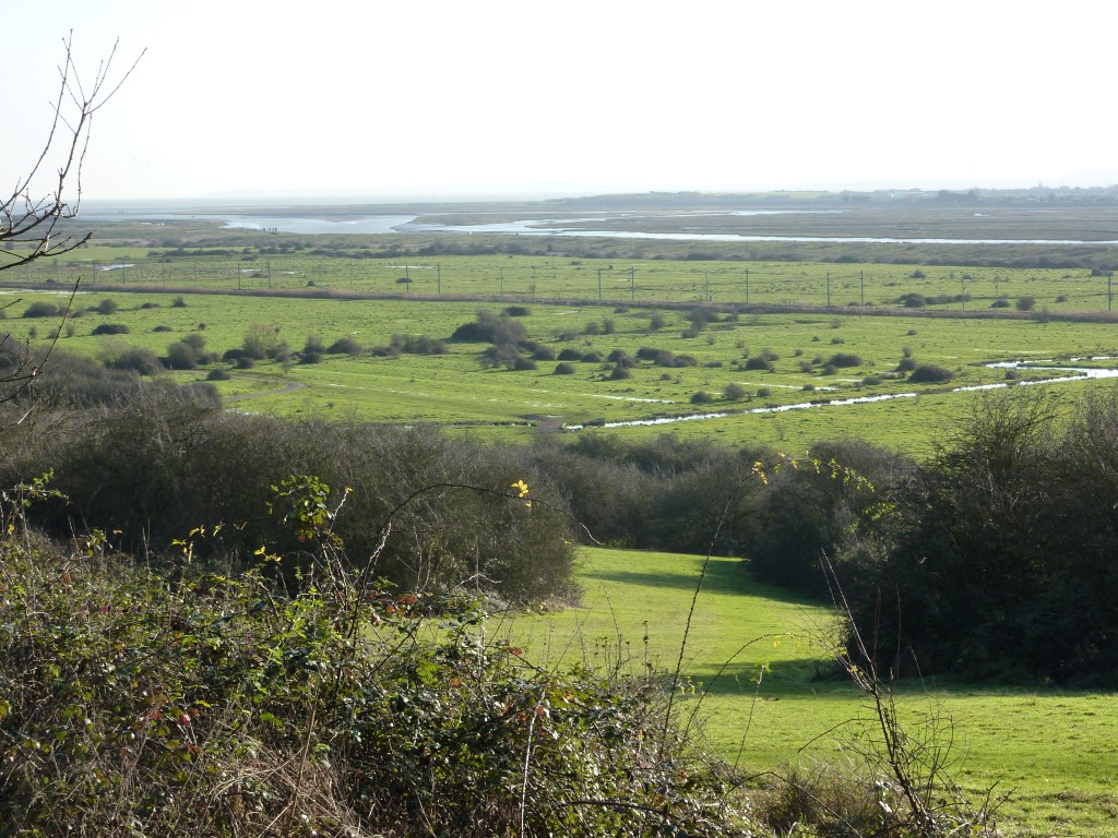
We crossed the road and made our way past the war memorial to climb the steep path which led up to the western edge of the downs.’ …‘These low lying hills seldom rising more than 200 feet above sea level, run roughly parallel to the River Thames and extend about three miles east from Benfleet to Leigh….’ ‘Not surprisingly some of the land is still farmed or given over to grazing. For many years the Salvation Army has worked its farming colony here on an estate of 1,500 acres or so, and on the sunnier south facing slopes one or two orchards are still to be seen.’
‘In July 1934 the local council became the owners of much of the land comprising the Hadleigh Downs and in that same year Sir Edgar Bonham-Carter officially opened this “Magnificent space” which has been dedicated to the public in perpetuity.’
‘From Benfleet it is about one and a half miles to Hadleigh Castle over field and footpath, through coppice and clearing which at any time of year are a delight to see. Hawthorn and hollybush, bramble and briar spread in an expansive carpet down to the lush meadows which lead to the water’s edge.’….
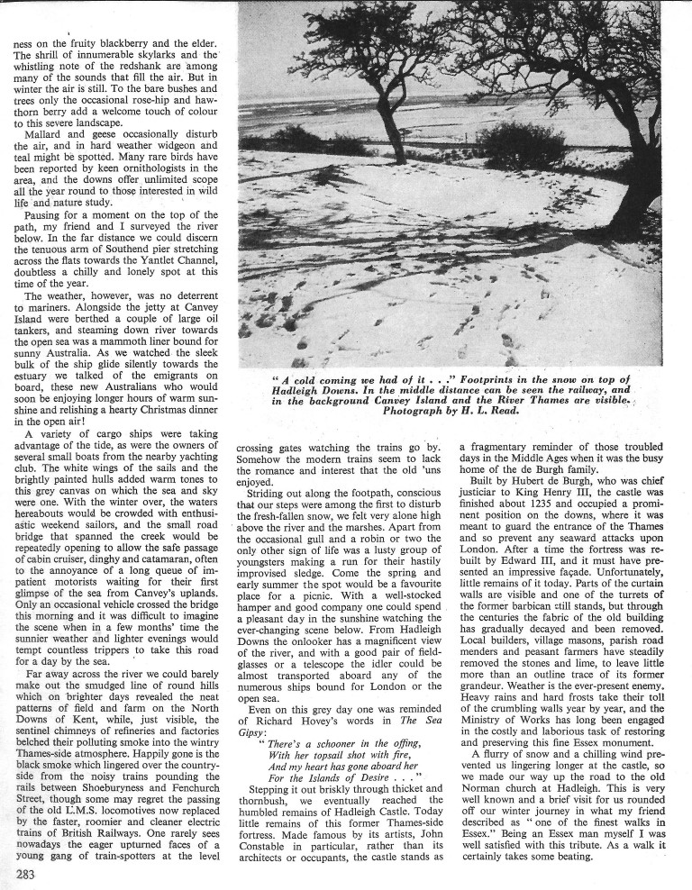
‘Pausing for a moment on top of the path, my friend and I surveyed the river below. In the far distance we could discern the tenuous arm of Southend pier stretching across the flats towards the Yantlet Channel.’….
‘Alongside the jetty at Canvey Island were berthed a couple of large oil tankers, and steaming down the river towards the open sea was a mammoth liner bound for sunny Australia….. We talked of the emigrants on board, these new Australians who would soon be enjoying longer hours of sunshine.’
‘A variety of cargo ships were taking advantage of the tide as were the owners of several small boats from the nearby yachting club. With the winter over, the waters hereabout would be crowded with enthusiastic weekend sailors, and the small road bridge that spanned the creek would be repeatedly opening to allow the safe passage of cabin cruiser, dinghy and catamaran often to the annoyance of a long queue of impatient motorists waiting for their first glimpse of the sea from Canvey’s uplands.’…
‘Happily gone is the black smoke which lingered over the countryside from the noisy trains pounding the rails between Shoeburyness and Fenchurch Street, though some may regret the passing of the old LMS (London Midland Scottish Railway) locomotives now replaced by faster roomier and cleaner electric trains of British Railways. From Hadleigh downs the onlooker has a magnificent view of the river.’
‘Stepping it out briskly through thicket and thornbush we eventually reached the humble remains of Hadleigh Castle…. Unfortunately little remains of it today.’
‘We made our way up the road to the old Norman church at Hadleigh. This rounded off our wintery walk in what my friend described as “one of the finest walks in Essex.” Being an Essex man myself I was satisfied with this tribute. As a walk it certainly takes some beating.’
*Date – The railway line was electrified in 1962. The article was written sometime after that but before 1969 when the Crown was partly demolished by a lorry crashing into it.
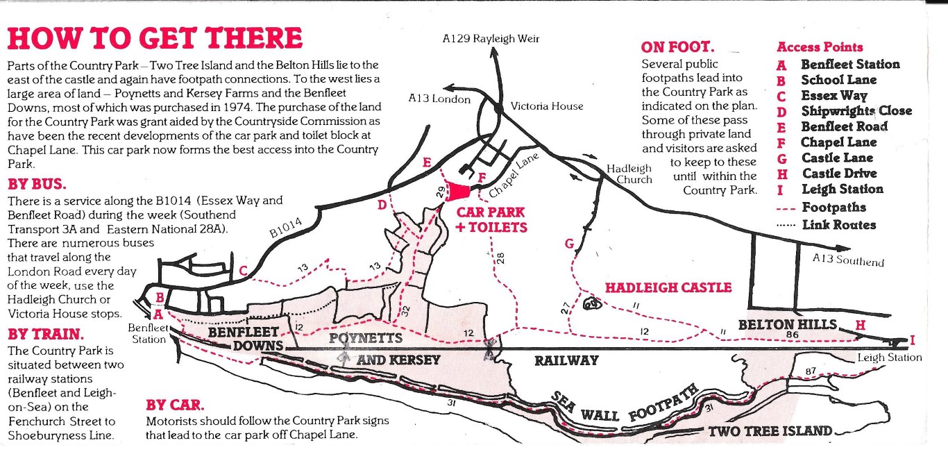
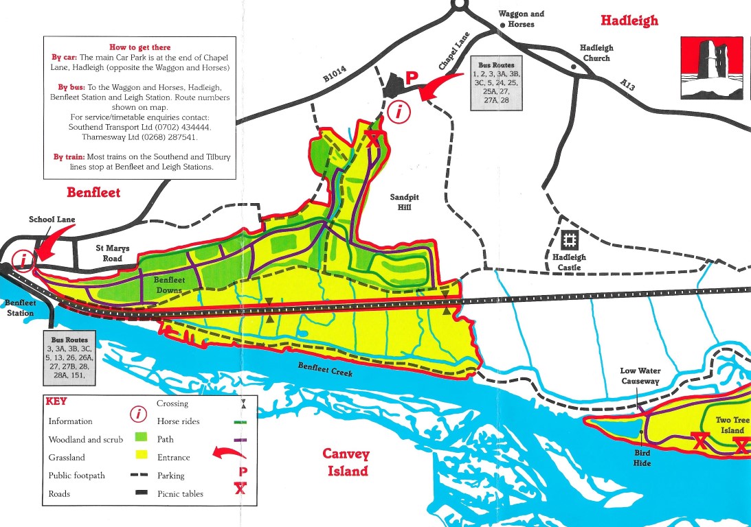
The route taken in this article would have followed one of the paths shown on this map. However it is unknown as to how old this route is but it could date back centuries as an easy route to connect Benfleet to the farms on the Downs and on to Hadleigh Castle and the village.
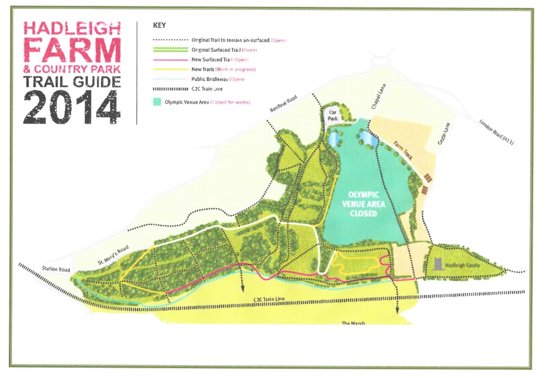
The map above shows Poynett’s and Kersey’s Farms which would have been the farms spoken about in this article, now part of the country park. They were both purchased for the park in 1974 with a grant aided by the Countryside Commission. (Information form Hadleigh Castle Country Park Map leaflet) Date of map late 1970’s? The Orchards are now long gone and the Olympic Mountain bike track has taken over the steepest part of the Salvation Army Farm.
The Olympic Legacy is developing the site and expanding the facilities to cater for world class mountain biking with the opening at Easter of 2015 of The Hub, the new visitors centre at Hadleigh.


 trail guide 2014.")


No Comments
Add a comment about this page