BOYCE HILL FARM
In 1841 the farm consisted of 100 acres, 3 roods, and 23 perches of which the majority were given over to arable crops, with grazing as a secondary land use. Nearly five acres were taken up with buildings and gardens.
It stretched from Church Corner to Vicarage Hill and beyond, keeping to the right-hand side of the High Road, heading in a London direction as far as Hopes Green.
The local golf club inaugurated in 1922 keeps the name alive as does the ward name of Boyce. Searching under the terms “Boyce Hill golf”, will bring you photos of the course, which is known for its splendid views.
Untypically ownership of the farm is divided among several gentlemen – Henry Wood, Marshall Turner and Jonathan Wood. Likewise, the tenant farmers included William French, Henry Martin and John Harding. I can only guess that because of its size the farm was subdivided into more manageable units.
In December 1944 a V2 rocket landed on the golf course causing one serious injury and thirteen slightly injured. As for damage to property 40 homes suffered serious damage and a further 101 slight damage.
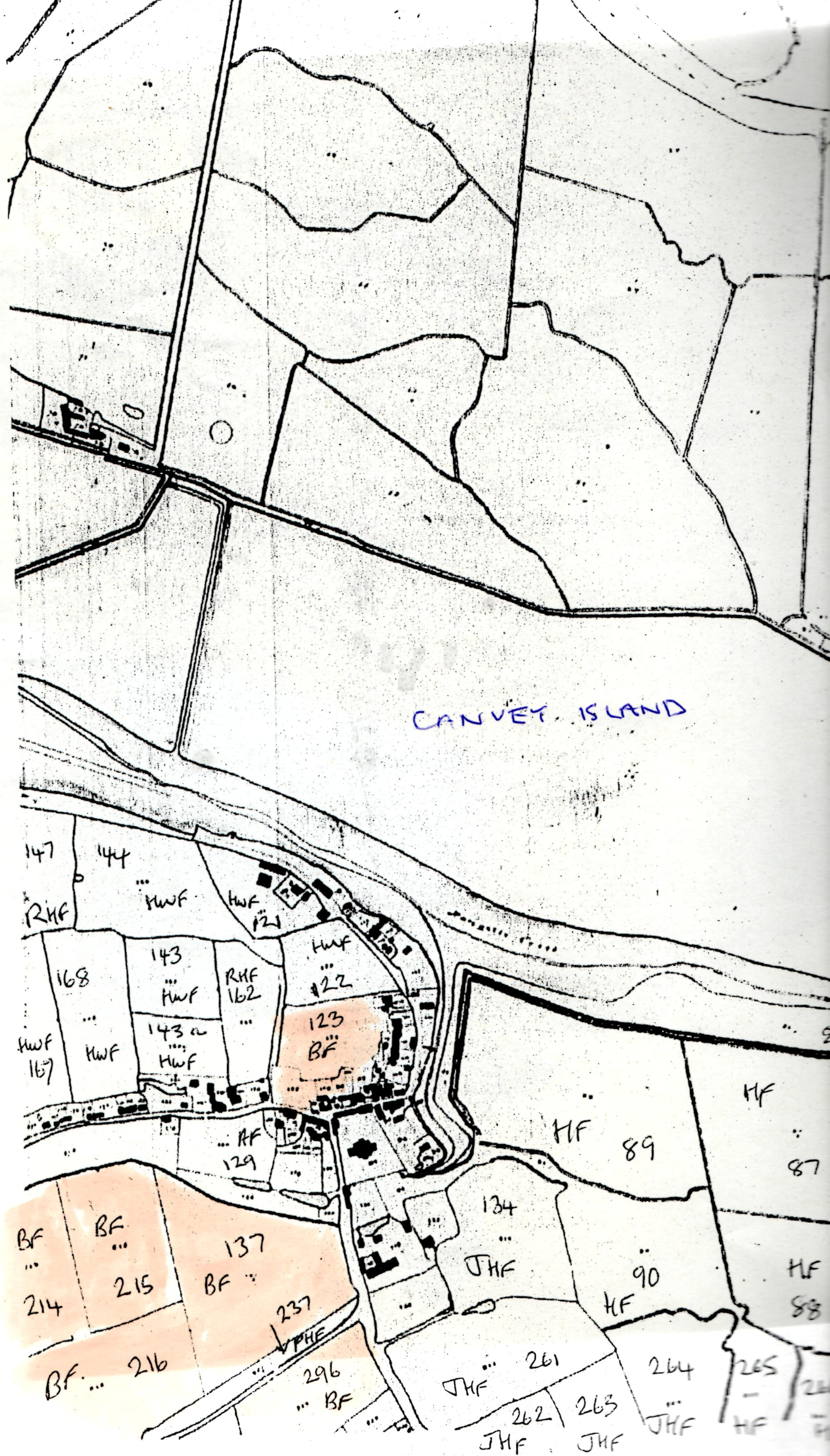
The map below indicates in orange the areas farmed as part of Boyce Hill Farm in 1841. Remember that the convention at that time placed Canvey Island above Benfleet on the map.
![Boyce Hill farm shown on the 1841 tithe map [1]](https://d2s6yrbyrp01f9.cloudfront.net/wp-content/uploads/2020/04/Boyce-Hill-upper-388x681.jpg "Boyce Hill farm shown on the 1841 tithe map [1]")
![Boyce Hill farm shown on the 1841 tithe map [2]](https://d2s6yrbyrp01f9.cloudfront.net/wp-content/uploads/2020/04/Boyce-Hill-lower-485x681.jpg "Boyce Hill farm shown on the 1841 tithe map [2]")


No Comments
Add a comment about this page