I spoke to Mark Thres at the launch of my latest book, The Jottings of a Thames Estuary Ditch-crawler, at which he showed me ‘the chart’ however, it is not a chart as such, but a pilotage chartlet page from a pilot book. It was interesting though. Nick Ardley.
By Nick Ardley (22/11/2011)
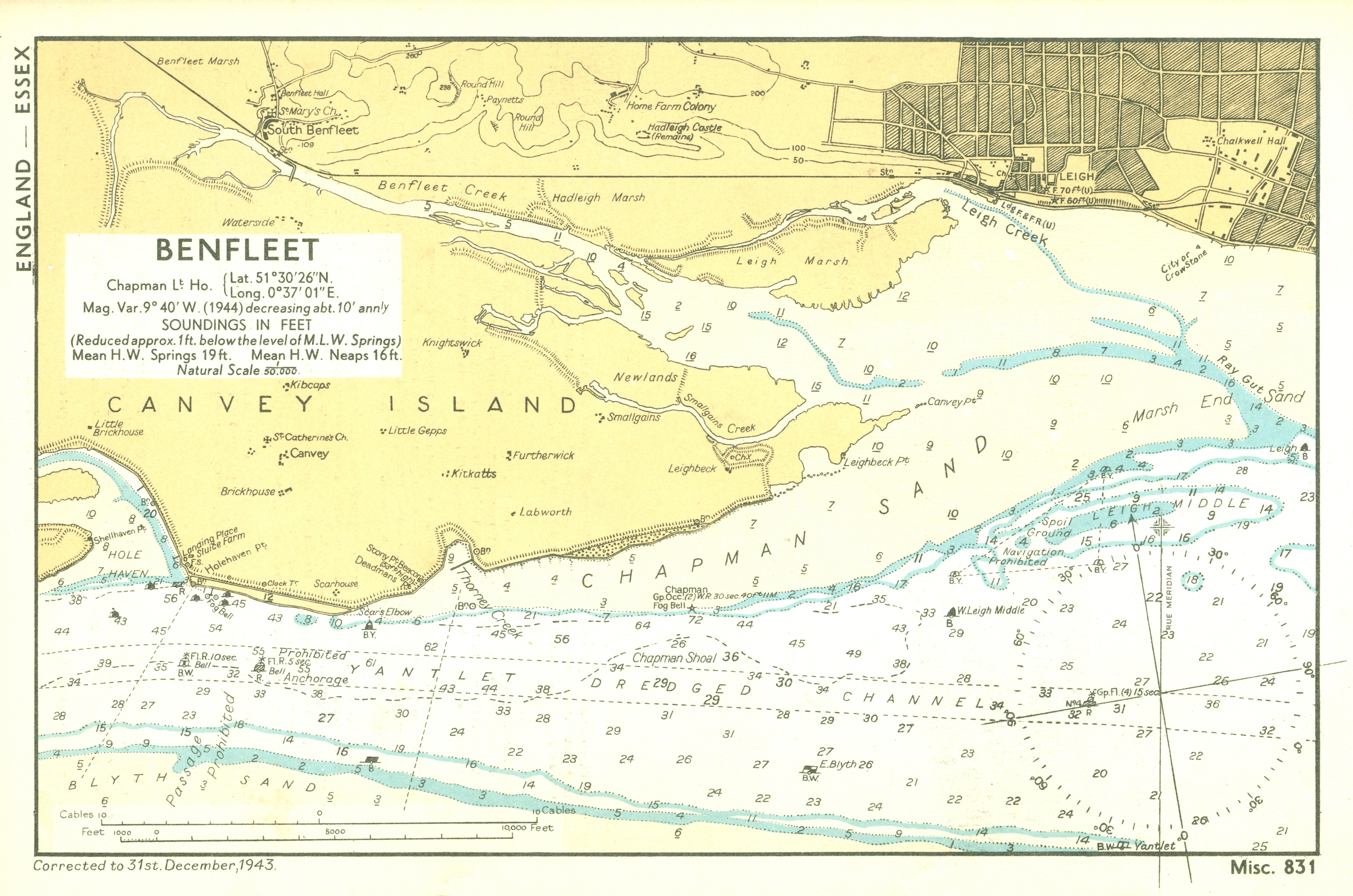
I was fascinated with this section of chart from the 1940s: I have recently written about changes to the area east of Canvey Point, specifically the way the channels leading into the Ray have changed over the last 120 years – back to the start of the Corinthian sailing era. The writing is within a chapter in a book due to be published in around six months time. I would, if possible, like to gain sight of this old chart, or, preferably, obtain a clear copy. Is this possible, or can you put me in touch with the charts owner. Copyright, of course, still rests with the UK Hydrographic Office… Many thanks, Nick Ardley


Comments about this page
Add your own comment
I spoke to Mark Thres at the launch of my latest book, The Jottings of a Thames Estuary Ditch-crawler, at which he showed me ‘the chart’ however, it is not a chart as such, but a pilotage chartlet page from a pilot book. It was interesting though. Nick Ardley.
I was fascinated with this section of chart from the 1940s: I have recently written about changes to the area east of Canvey Point, specifically the way the channels leading into the Ray have changed over the last 120 years – back to the start of the Corinthian sailing era. The writing is within a chapter in a book due to be published in around six months time. I would, if possible, like to gain sight of this old chart, or, preferably, obtain a clear copy. Is this possible, or can you put me in touch with the charts owner. Copyright, of course, still rests with the UK Hydrographic Office… Many thanks, Nick Ardley
Add a comment about this page