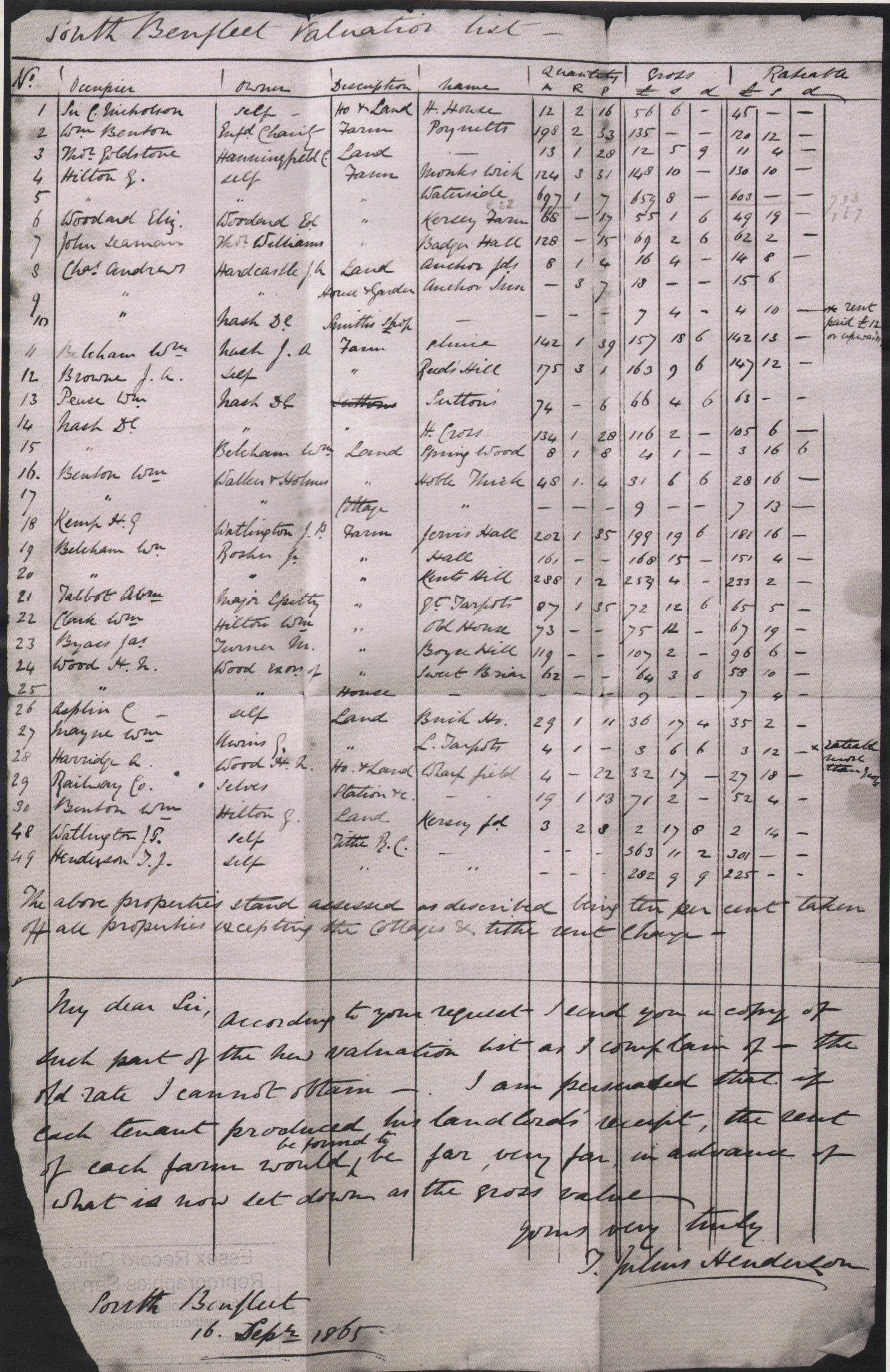
Similar to the 1841 tithe map in that it lists properties, their owners, their tenants, land use, but in addition each property’s value for tax purposes. The process was surprisingly transparent with ratepayers able to see what each was paying, Mind you there were only 49 of them in 1865.


No Comments
Add a comment about this page